

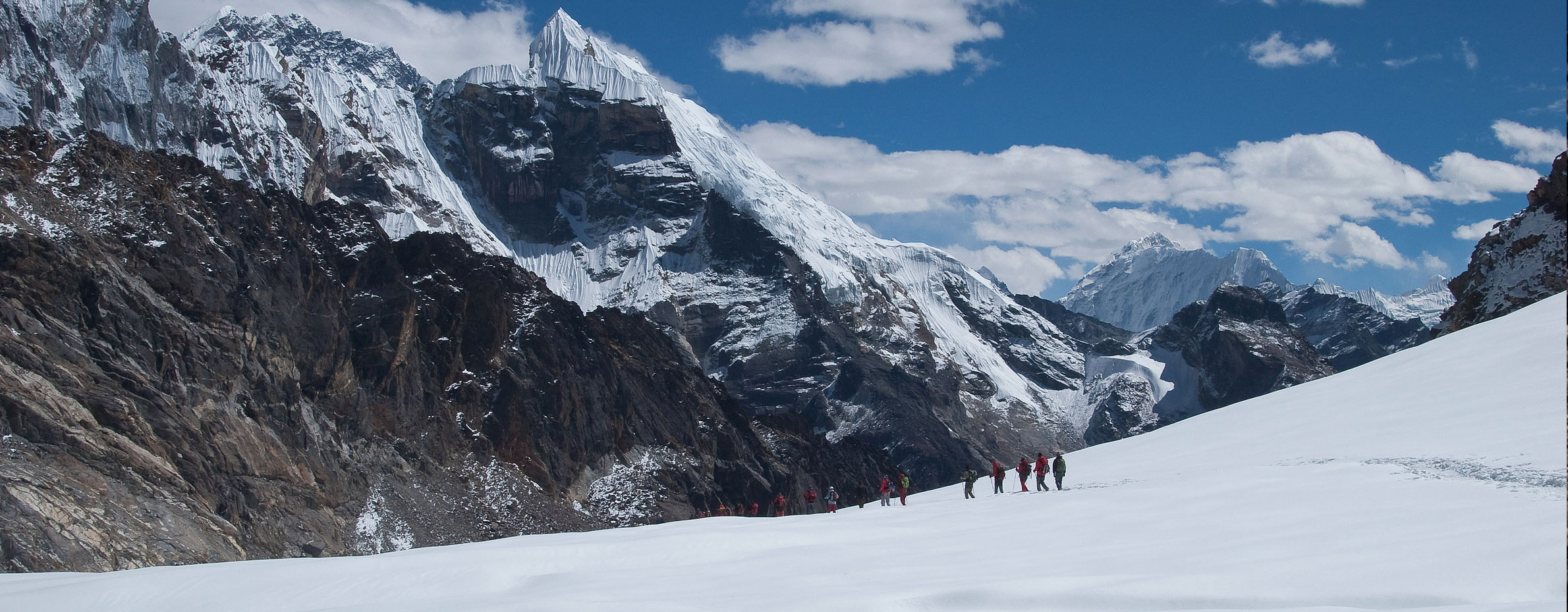
Cho La Pass at an altitude of 5,420 meters (17,782 feet) is one of the three passes in the Everest region alongside Kongma La Pass (5,535 meters) and Renjo La Pass (5,340 meters). The Cho La Pass adventure takes you to the deepest part of the Khumbu region and is considered one of the most exhilarating and adventurous trekking expeditions in the world.
This high Himalayan pass connects the two most popular trekking routes of Khumbu; the Everest Base Camp trek and Gokyo Valley. Famous for its scenic mountain views and extreme landscapes, Cho La Pass adventures take you across the glacier moraines and rocky rugged trails. This iconic Himalayan pass is perfect for trekking enthusiasts who are looking for extending their adventure in the Everest region or simply looking for thrills to conquer one of the three highest and longest passes of the Himalayas.
Cho La Pass Difficulty- How Hard is Cho La Pass?
There are several factors that contribute to the Cho La Pass difficulty level, as it is one of the most extreme mountain passes, it would be wise not to underestimate the challenge this glorious expedition of the Himalayas packs. To assess how hard is Cho La Pass actually, let’s check out some of the significant challenges trekkers have to face during the expedition.
Cho La Pass Altitude
Without a doubt, the thrilling and exciting trekking adventure to one of the highest Himalayan passes has significant altitude jump points. As there is a risk of altitude sickness to a human body beyond the altitude of 2,500 meters, the Cho La Pass altitude sits at an elevation of 5,420 meters from sea level poses a great risk for altitude sickness.
Especially, the beginner trekkers who have no prior high-altitude trekking experience, the lower oxygen saturation level at such extreme altitudes can trigger altitude sickness symptoms. Thus properly training for the expedition, including acclimatization days for better adaption to the rising environment, eating healthy, and staying hydrated throughout the expedition is the mandatory requirement for this Himalayan high pass adventure.
Cho La Pass Weather
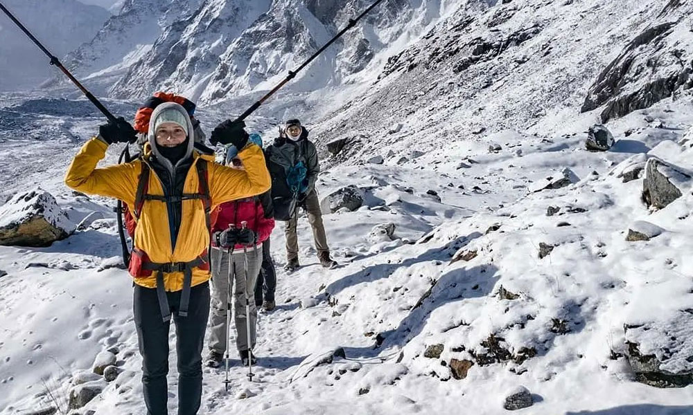
Besides the extreme elevation gain during the expedition, the alpine cold and harsh environment of the region is another major challenge to overcome during this Himalayan passes adventure. Normally, the high-altitude climatic conditions can be quite unpredictable and hectic at times, same goes for the Cho La Pass weather conditions. The alpine environment of the trail carries the risk of hypothermia, frostbite, and trench foot are just a few of the possible outcomes of this alpine adventure.
But, with the proper wear and precaution, these challenges are not hard to overcome. Also, be mindful about scheduling your adventures during the peak seasons like autumn (September- November) and spring (March-May); the climatic conditions are pretty much stable during these seasons and the days are on the warmer side.
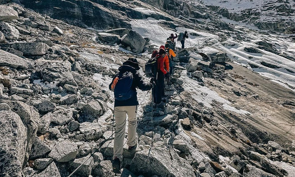
Rugged and Steep Trails
Cho La Pass expedition takes place in the remote part of the Himalayas, although this expedition takes you through the scenic routes to the heart of the Khumbu region, it is definitely not an easy walk. Passing across the wild forests, several steep segments, glacial moraines and ridges, and rocky rugged trails, this expedition is physically exhausting. Plus, you need to use crampons or microspikes to walk across the glacial segments of the adventure.
Thus, unless you are not well prepared for this expedition to overcome these trekking route difficulties, just dragging yourself to the finish line will not be a fun experience at all. The minimum recommended training period before the Cho La Pass expedition is 8- 12 weeks.
Remoteness
You need to understand that this Himalayan Pass adventure is a remote exploration, the remoteness of the region is another factor that contributes to the overall Cho La Pass difficulty level. The services of the teahouses along the route are pretty much basic and during the remote part of the exploration, you will need to use tented accommodation. Although there is a luxury trekking option available for the mainstream Everest Base Camp route, for the remote section of the Cho La Pass you will have to make do with the available services.
The same goes for the range of amenities and other services like healthcare, transportation, and technological infrastructure, they are quite limited. Regardless of that, thousand of trekking enthusiasts pour into the region for the glorious and remarkable experience of this Himalayan expedition. As a way to escape from the busy urban life to the solitude of this remote journey and reconnect with mother nature.
Where is Cho La Pass? Cho La Pass Map
Cho La Pass is located in the northeastern part of Nepal in the Solukhumbu district. This high pass rest in the Chola range of the Himalayas and connect Dzongla Village (4,830 meters) to the east and Thagnak Village (4,700 meters) to the west side. The Cho La Pass map generally consists of two starting point, the trekking enthusiast on the exploration of the Himalayas generally start from either Dzongla (from the east) or Gokyo (from the west).
When taking the Cho La Pass map route from the eastern side, Dzongla, the trail is relatively straightforward, as you hike above the tree line and there is no risk of accidental slip onto a neighboring valley. The route in this trekking map is quite stable and relatively flat for about 1- 2 km, then after passing a small stream across the rocky chute, you enter the steep ascending zone and follow the left side of the glacier (from the south). Even though it is not a difficult trail to follow, it is advised that you shouldn't attempt the crossing pass with bad health conditions.
On the other hand, climbing from the western side, Gokyo is quite challenging as the route is pretty steep. There is a huge drop of about 250 meters (82 feet) in about half- kilometers en route as the trail dives into the valley and follows the small stream towards Dragnag.
How to Reach Cho La Pass?- Everest Base Camp Via Cho La Pass
One of the most iconic and classical ways to do the Cho La Pass trek is doing the expedition with the Everest Best Camp package. In this expedition, the route follows pretty much the same mainstream trekking route of the Everest Base Camp trek; starting the adventure from Lukla (2,800 meters), moving along the trail from Namche Bazaar (3,440 meters), Tengboche (3,790 meters), Dingboche (4,350 meters), Lobuche (4,950) to Gorakshep (5,164 meters) and finally at the Everest Base Camp (5,364 meters).
From there on, the trekking route toward Thagnak ‘Dragnak’ (4,700 meters) from Dzongla (4,830 meters), crossing over the Cho La Pass (5,420 meters). And, if you have booked an extensive package, it will also include the exploration of Gokyo Valley (4,790 meters) and Gokyo Ri (5,483 meters). Then after completing the expedition you will follow down the trail to Namche Bazaar and retrace your steps back to Lukla to conclude the expedition. Although this is the most popular way to do the Cho La Pass trek, you can choose from other itinerary packages as well which explore other prospects of the Khumbu region specifically.
You may also like: